30 Mar Port of Lavagna
Posted at 16:20h
in
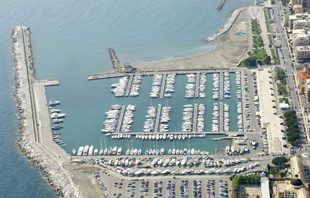
[vc_row css_animation="" row_type="row" use_row_as_full_screen_section="no" type="full_width" angled_section="no" text_align="left" background_image_as_pattern="without_pattern"][vc_column][vc_column_text]The most recent ReteMet structure was installed at Lavagna, one of the busiest leisure marinas in the Mediterranean. The anemometer was fixed at the top of the control tower where the marina offices are in a position particularly...